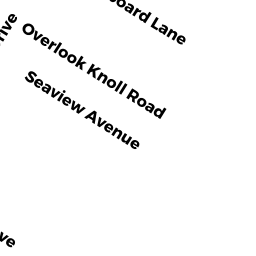
9 STARBOARD LN
Owner Information
RISKO, M FRANCES & JOHN H TRS
90 WEBSTER ST
NEWTON, MA 02465


Property Details
9 STARBOARD LN is classified as a Single Family Residential (Cape).
The primary structure on this property was built in 1952. There are 1,612ft2 of built area within this property. There is 1,612ft2 of residential/living space within this property. This property is listed as having 8 rooms.
9 STARBOARD LN is valued at $868,200. The land is valued at $666,300 and the structures are valued at $201,500. There is an additional valuation of $400 on this property.
This property is in Zone R3. Confirm with local Zoning Board authorities to ensure there are no overlays or other easements on this property.
The most recent deed for 9 STARBOARD LN is recorded at the local registrar in Book 192165, Page CTF. 9 STARBOARD LN was last sold on Friday, August 13, 2010 for $10.
Assessment data from fiscal year 2022.
Flood Data
According to the FEMA National Flood Hazard Layer, this property does not appear to be in a flood zone. It may also be in an area not yet reviewed. Nonetheless, confirm this information prior to taking any action.
To view the flood hazards around this property, create a FEMA "Firmette" Map of the area around 9 STARBOARD LN.
Broadband Internet Providers
| Provider | Type | Bandwidth (mbps) | |
|---|---|---|---|
| Verizon New England Inc. | DSL | 5 | 0 |
| Comcast | Cable | 1000 | 35 |
| Viasat Inc | Satellite | 35 | 3 |
| GCI Communication Corp. | Satellite | 0 | 0 |
| HughesNet | Satellite | 25 | 3 |
| VSAT Systems, LLC. | Satellite | 2 | 1 |
Broadband service provider data from December 2020.
Adjacent Properties
- 6 OVERLOOK KNOLL RD
Single Family Residential owned by BEHREND, MARYELLEN TR - 10 OVERLOOK KNOLL RD
Single Family Residential owned by CASAL, FRANK E & KATHLEEN M - 11 STARBOARD LN
Single Family Residential owned by LEGRAW, G STEPHEN & JUDITH W - 5 STARBOARD LN
Single Family Residential owned by SHANAHAN, RICHARD & NANNETTE